
GNSS Data
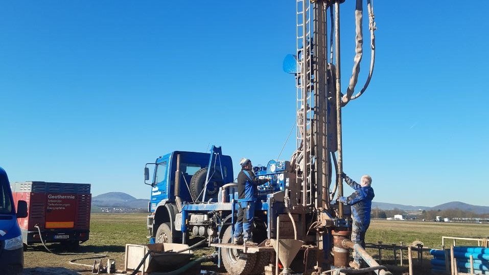
CVO - Central European Volcanic Province Observatory
The primary scientific goal of the Central European Volcanic Province Observatory is to better understand and map the processes in transcrustal magma systems beneath distributed intraplate volcanic fields, and to assess their volcanic hazard and the…


GFZRNX - RINEX GNSS Data Conversion and Manipulation Toolbox
GFZRNX is a toolbox designed and created for the needs of the GNSS community. It supports RINEX observation, navigation and meteorological data. The major tasks include checking, repairing and manipulating (sampling, selection of satellite systems a…

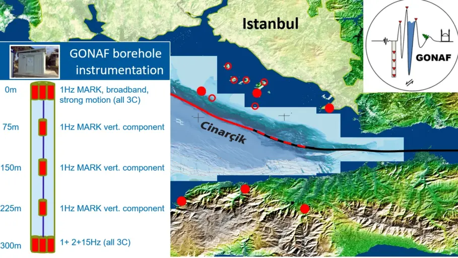
GONAF - Geophysical Observatory at The North Anatolian Fault
GONAF (Geophysical Observatory at the North Anatolian Fault) is a combined surface and downhole based observatory to measure tectonic deformation transients (seismic and aseismic) along the overdue Marmara segment of the North Anatolian Fault Zone (…

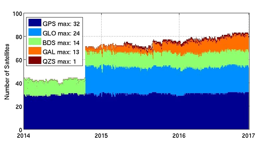
MGEX - Analysis Center of the Multi-GNSS Experiment
The Multi GNSS Experiment (MGEX) was initiated by the IGS in 2012. In MGEX all available signals of the new GNSS satellites are analysed. Currently, seven IGS analysis centers generate consistent and precise orbits and clock corrections of the new s…
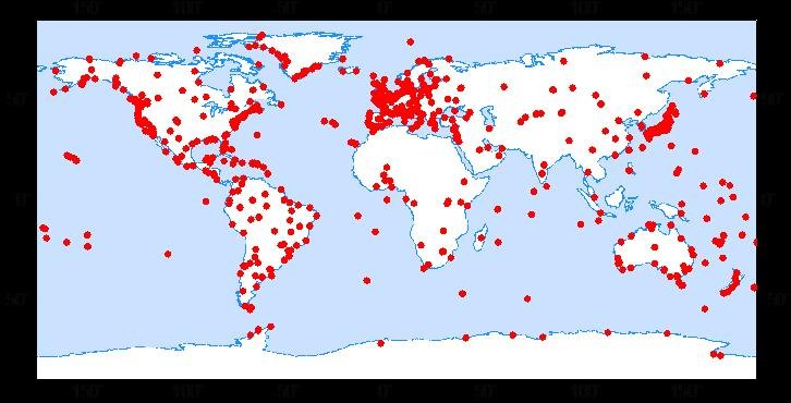
TIGA - Processing Center of the Tide Gauge Benchmark Monitoring Working Group
Being a modern geodetic measuring method, GNSS (Global Navigation Satellite Systems) has reached an important role in geosciences. Within the scope of the Tide Gauge Benchmark Monitoring Working Group (TIGA-WG) of the IGS, GFZ analyses and reprocess…