
TIGA - Processing Center of the Tide Gauge Benchmark Monitoring Working Group
Contact
GFZ Websites
Data Access via
Infrastructure belongs to
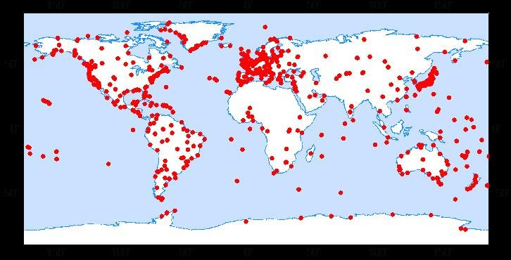
Being a modern geodetic measuring method, GNSS (Global Navigation Satellite Systems) has reached an important role in geosciences. Within the scope of the Tide Gauge Benchmark Monitoring Working Group (TIGA-WG) of the IGS, GFZ analyses and reprocesses GNSS data of stations near tide gauges (Deng et al, 2014). This allows us to monitor tide gauges for vertical land deformations, e.g. due to postglacial uplift. TIGA also contributes to the calibration of satellite altimeters and the unification of height systems (Hunegnaw et al., 2017).
In conjunction with circa 400 global IGS stations, GFZ processes data of almost 500 GNSS stations near tide gauges between 1994 and today. In the first TIGA combination there are contributions from 3 international ACs. The GFZ TIGA solution shows the best accuracy among the three submitted solutions (Hunegnaw et al., 2017). Since the GFZ TIGA processing complied with the accords of the 2nd IGS reprocessing campaign, our reprocessed solutions contributed to the determination of the ITRF20014 (Rebischung et al., 2016). In that context the GFZ solution contained the most stations among all of the nine solutions. Because it is the only solution that contains all IGS stations, the IGS Analysis Center Working Group decided at the 2017 IGS Workshop in Paris, to routinely deliver the GFZ TIGA solution to the IGS in order to ensure, that all IGS stations are contained in the combined weekly IGS solutions.
Categories
Data Types
Disciplinary Keywords
Links
GFZ Websites
Data Access via
Relationships
- is part of