Search filter
Clear filters
-
- GFZ
- Department 1 Geodesy
- Section 1.2 Global Geomonitoring and Gravity Field
- Department 2 Geophysics
- Section 2.1 Physics of Earthquakes and Volcanoes
- Section 2.2 Geophysical Imaging
- Section 2.4 Seismology
- Section 2.6 Seismic Hazard and Risk Dynamics
- Department 4 Geosystems
- Section 4.1 Lithosphere Dynamics
- Section 4.2 Geomechanics and Scientific Drilling
- Section 4.4 Hydrology
- Department 5 Geoinformation
- Section 5.2 eScience Centre
Natural Hazards
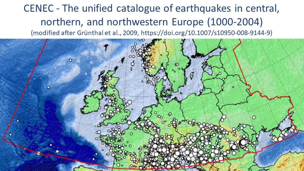
CENEC 2008 - Mw based Earthquake Catalogue for Central, Northern and Northwestern Europe
The unified catalogue of earthquakes in central, northern, and northwestern Europe: Grünthal et al. (2009) published a catalogue for central, northern, and northwestern Europe with unified Mw for events with Mw ≥ 3.5 in the time frame 1000-2004. Thi…
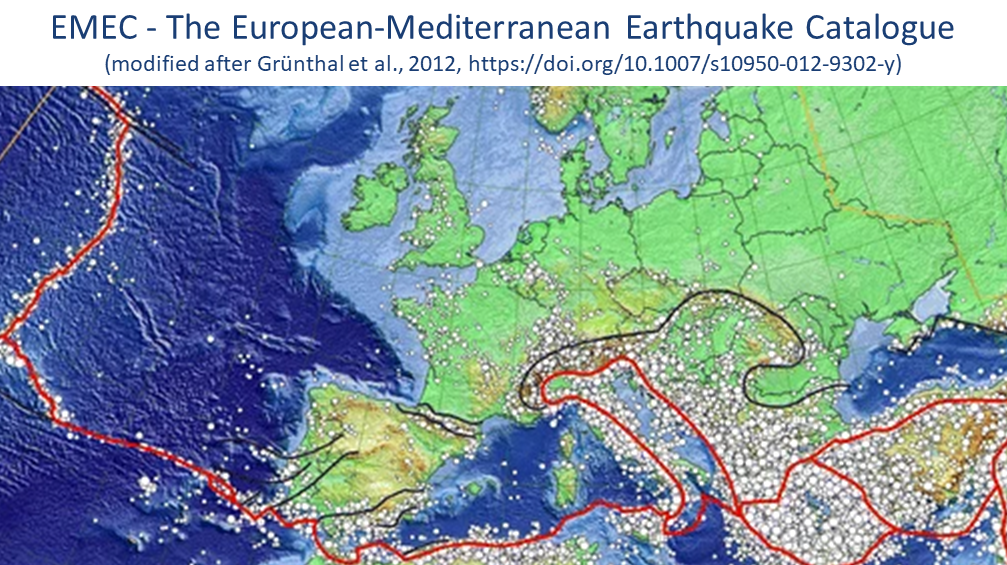
EMEC - The European-Mediterranean Earthquake Catalogue (Version 2021 and earlier versions)
EMEC-2021 is a catalogue of tectonic earthquakes for the broader Mediterranean area, harmonised into a single magnitude scale, Mw (Lammers, Steffi et al., 2023). It is an extended version of “The European-Mediterranean Earthquake Catalogue (EMEC) fo…


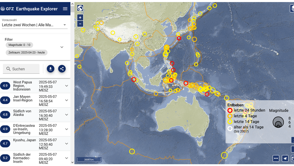
GE Seismic Network - GEOFON Global Seismic Network
In 2018 the GEOFON global seismic network consists of more than 80 active high quality stations with real-time acquisition. The network plays a leading role in global real-time seismology providing valuable data for almost all fundamental and applie…
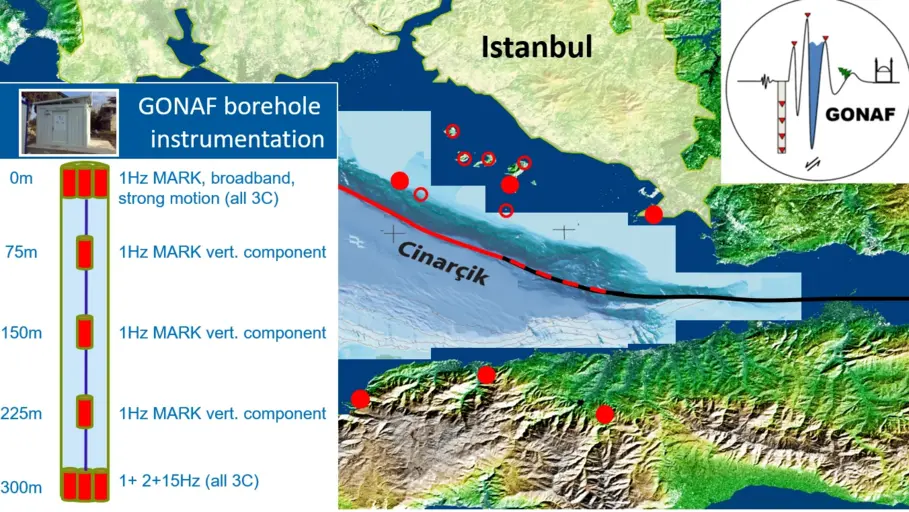
GONAF - Geophysical Observatory at The North Anatolian Fault
GONAF (Geophysical Observatory at the North Anatolian Fault) is a combined surface and downhole based observatory to measure tectonic deformation transients (seismic and aseismic) along the overdue Marmara segment of the North Anatolian Fault Zone (…
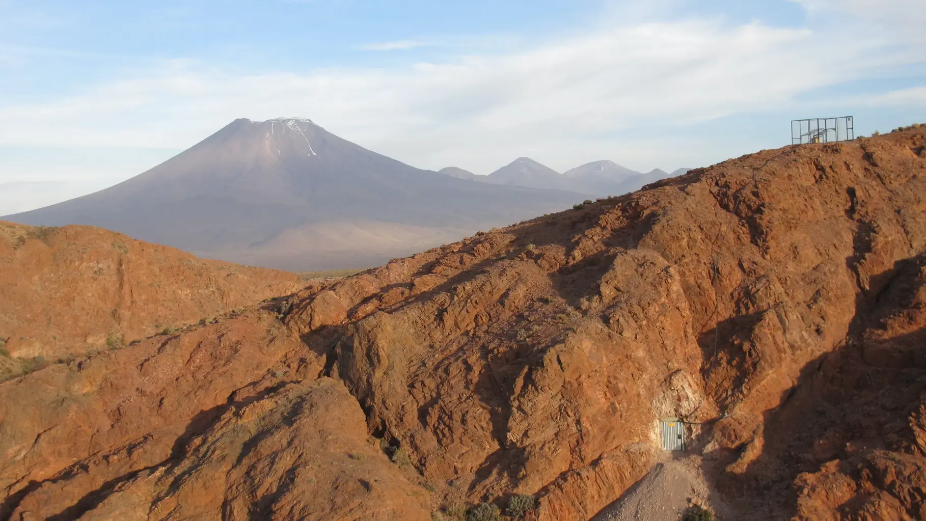
IPOC - Integrated Plate Boundary Observatory Chile
IPOC is an international network of institutions and scientists organising and operating a distributed system of instruments and projects dedicated to the study of the subduction system, its role in landscape evolution, and associated geohazards at …

SHEEC - the SHARE European Earthquake Catalogue 1900-2006
The SHARE European Earthquake Catalogue (SHEEC) 1900-2006 has been compiled by GFZ Potsdam in the frame of an independant project and represents a temporal and spatial excerpt of "The European-Mediterranean Earthquake Catalogue" (EMEC) for the last …
SMARTIES - Supercritical fluids and MAgma Reconnaissance for Transformative Iceland Energy Solutions
Recognizing that the exploration and harnessing of magmatic and geothermal reservoirs involves many disciplines, the mission of “SMARTIES” is to implement a long-term observatory facility together with episodic field experiments for defining, testin…