
Satellite Laser Ranging Station Potsdam
Contact
GFZ Websites
Data Access via
Infrastructure belongs to
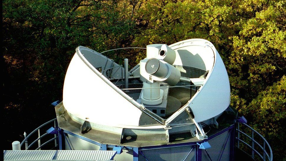
The Satellite Laser Ranging (SLR) Station of the GFZ Potsdam has been continuously operating within the framework of the International Laser Ranging Service (ILRS) since January 2003. The method of satellite laser ranging was established in 1964 and still serves as one of the most precise space geodetic techniques with continuously improving accuracy. The main scientific contributions of SLR are:
(1) Monitoring of Earth rotation parameters (polar motion and length of day), (2) Monitoring of 3-dimensional deformations of the solid Earth (station coordinates and velocities), time-varying geocenter coordinates, (3) Static and time-varying coefficients of the Earth’s gravity field, (4) Calibration / validation of microwave instruments onboard of satellites
The principle of SLR is relatively simple: short laser pulses are transmitted by a telescope towards a Laser Retro Reflector (LLR) onboard a satellite. A small fraction of the reflected signal is received by a telescope and the two-way roundtrip time of the laser signal is retrieved from the receive and fire time of the pulses at the station. Via the speed of light and some corrections for the signal path within the atmosphere, the exact distance to the satellite at the given epoch is obtained. To maximise the signal reflection over the sometimes long distances of up to 25000 km to the satellites, mirrors of special design are used. These so called Laser Retro Reflectors (LRR) redirect the light always back to that direction where it came from. This priniciple is for example also utilized with so called "cateyes" which bikers use to be seen better when thy cycle in the dark. Satellites with LRRs onboard are tracked by SLR stations on all continents (except Antarctica) under coordination of the ILRS . The accuracy of the SLR technique is mainly depebds on the technical parameters of the ground stations and the quality of the satellite LRR. The Potsdam SLR station can measure the distance to satellites in orbits between 400 and 25000 km over the Earth with an accuracy and precision around 1 cm.