
Search filter
Clear filters
-
- GFZ
- Department 1 Geodesy
- Section 1.1 Space Geodetic Techniques
- Section 1.2 Global Geomonitoring and Gravity Field
- Section 1.3 Earth System Modelling
- Section 1.4 Remote Sensing and Geoinformatics
- Department 2 Geophysics
- Section 2.1 Physics of Earthquakes and Volcanoes
- Section 2.2 Geophysical Imaging
- Section 2.3 Geomagnetism
- Department 4 Geosystems
- Section 4.1 Lithosphere Dynamics
- Section 4.2 Geomechanics and Scientific Drilling
- Section 4.4 Hydrology
-
- Earth System Modelling
- Geochemistry
- Geology
- Geomagnetism
- Geomagnetism and Paleomagnetism
- Geophysics
- Geodynamics
- Global Change
- GNSS
- Gravimetry
- Hydrology
- Laboratory Keywords
- Analytical Methods
- Earth Remote Sensing Instruments
- Passive Remote Sensing
- Spectroradiometry
- In Situ/Laboratory Instruments
- Photon/Optical Detectors
- UV-VIS-NIR Spectrophotometry
- Spectrometers/Radiometers
- Fourier Transform Infrared Spectroscopy
- X-Ray Fluorescence Spectroscopy
- Magnetotellurics
- Natural Hazards
- Radio Occultation
- Radio Science
- Remote Sensing
- Satellite Laser Ranging
- Seismology
- Space Geodesy
- Superconducting Gravimetry
- Tectonophysics
- Volcanology
-
- Continuous GNSS Data
- Controlled Source Seismological Data
- Earth Orientation Parameters
- Final Products
- Global Gravitational Models
- GNSS Data
- GNSS Station and Satellite Metadata
- Model
- Observation Data and Derived Products for the Global Navigation Satellite Systems (GNSS)
- Passive Seismological Data
- Polar Motion
- Precession/Nutation
- Precise Station Coordinates
- Processed GPS Products
- Rapid Products
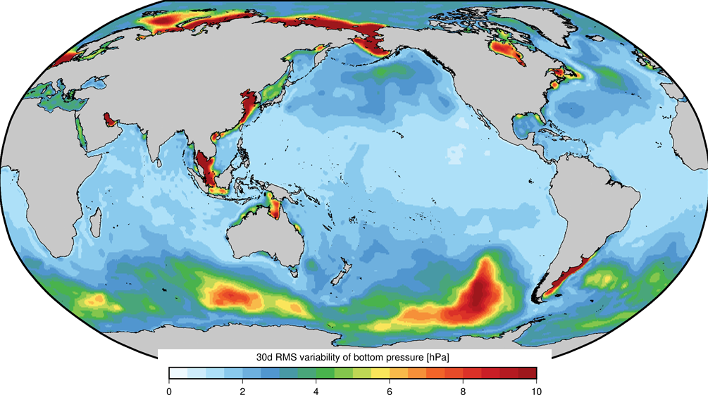
- Raw Gravity and Local Pressure Records and Products
- Satellite Clock Corrections
- Satellite Data
- Satellite Orbits
- Temporal Models
- Topography Related Models
- Ultra-rapid Products
- Universal Time
Geodesy and Gravity
AOD1B - GRACE Atmosphere and Ocean De-Aliasing Level 1B Product
The Atmosphere and Ocean De-Aliasing Level-1B (AOD1B) Product provides a priori information about temporal variations in the Earth's gravity field due to global mass variability in the Atmosphere and ocean. It is based on analysis and forecast data …

Atmospheric and Hydrospheric Surface Loading Deformations
GFZ provides surface loading products including vertical and horizontal deformations of the crust imposed by surface loading of geophysical fluids in Atmosphere, oceans, and the continental hydrosphere. Products are provided with a spatial resolutio…
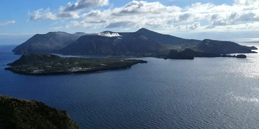
CVO - Central European Volcanic Province Observatory
The primary scientific goal of the Central European Volcanic Province Observatory is to better understand and map the processes in transcrustal magma systems beneath distributed intraplate volcanic fields, and to assess their volcanic hazard and the…

GFZRNX - RINEX GNSS Data Conversion and Manipulation Toolbox
GFZRNX is a toolbox designed and created for the needs of the GNSS community. It supports RINEX observation, navigation and meteorological data. The major tasks include checking, repairing and manipulating (sampling, selection of satellite systems a…


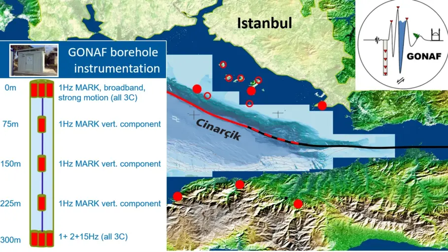
GONAF - Geophysical Observatory at The North Anatolian Fault
GONAF (Geophysical Observatory at the North Anatolian Fault) is a combined surface and downhole based observatory to measure tectonic deformation transients (seismic and aseismic) along the overdue Marmara segment of the North Anatolian Fault Zone (…
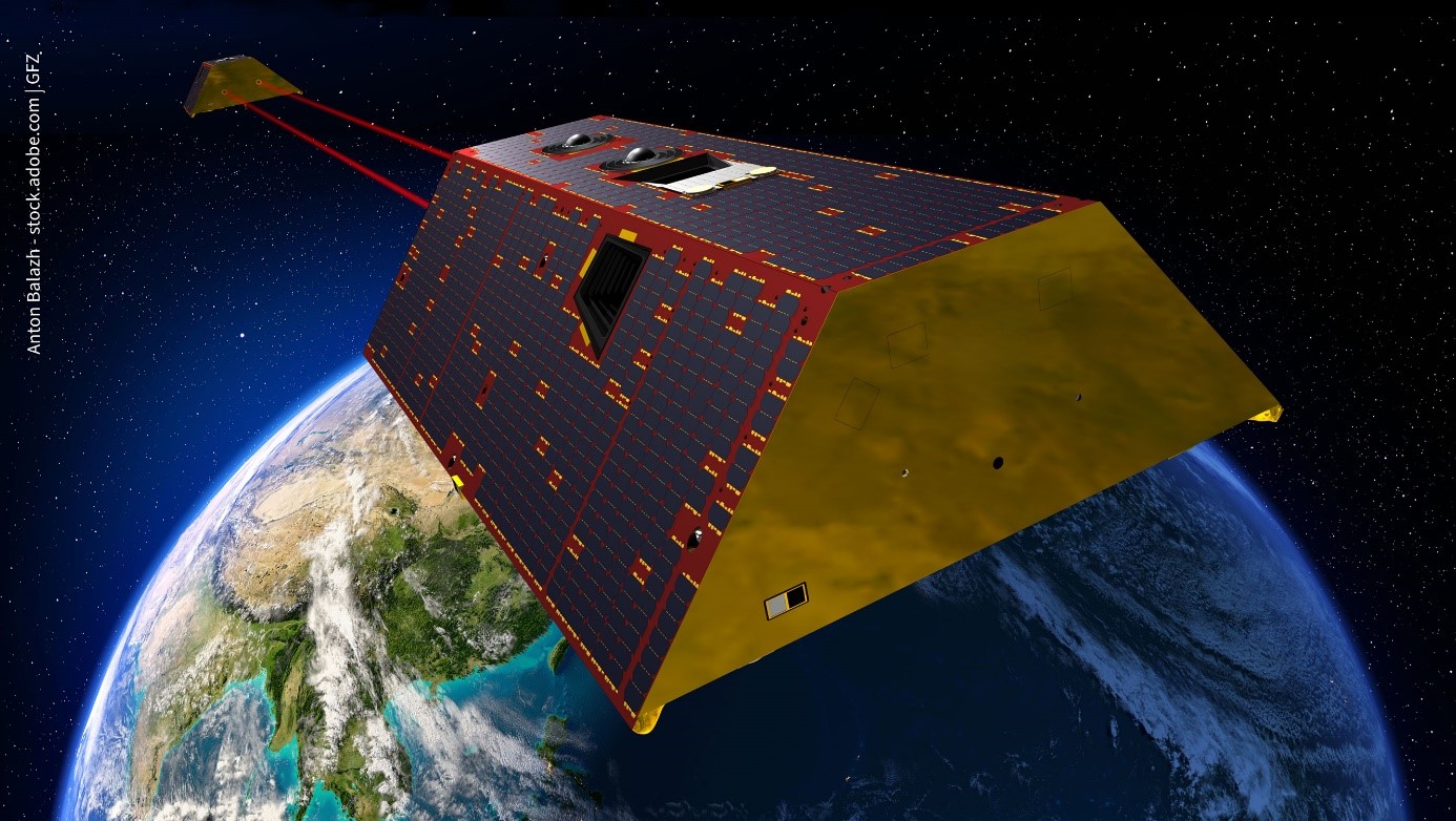
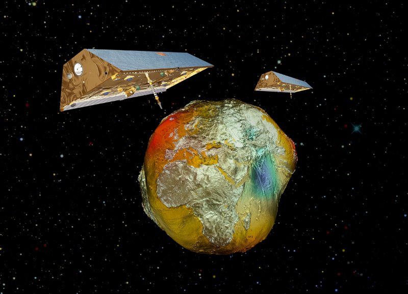
GRACE-C - Gravity Recovery and Climate Experiment Continuation Mission
The primary objective of the GRACE-C Mission is, as for GRACE and GRACE-FO, to obtain precise global and high-resolution models for both the static and the time variable components of the Earth's gravity field. As in the original GRACE missions, thi…
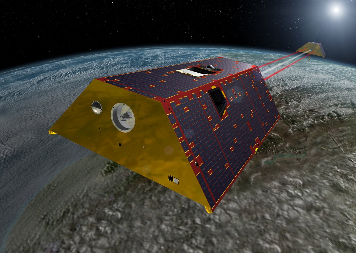
GRACE-FO - Gravity Recovery and Climate Experiment-Follow-On Mission
The primary objective of the GRACE-FO Mission is, as for GRACE, to obtain precise global and high-resolution models for both the static and the time variable components of the Earth's gravity field. As in the original GRACE mission, this goal is ach…

IAG Services - Services of the International Association of Geodesy (IAG Services)
The International Association of Geodesy (IAG) is the scientific organization in the field of geodesy. It promotes scientific cooperation and research in geodesy on a global scale and contributes to it through its various research bodies. It is a me…

ICGEM - International Centre for Global Earth Models
The determination of Earth’s global gravity field is one of the main tasks of geodesy: it serves as a reference for geodesy itself and provides essential information about the Earth, its interior and its fluid envelope for all geosciences. Thus, it …

IERS - International Earth Rotation and Reference Systems Service
The International Earth Rotation and Reference Systems Service (IERS) was established in 1987 by the International Astronomical Union and the International Union of Geodesy and Geophysics. The primary objectives of the IERS are to serve the astronom…
IGETS Database - Database of the International Geodynamics and Earth Tide Service
The International Geodynamics and Earth Tide Service (IGETS) is one of five services coordinated by the International Gravity Field Service (IFGS) of the International Association of Geodesy (IAG). The main objective of IGETS is to monitor temporal …

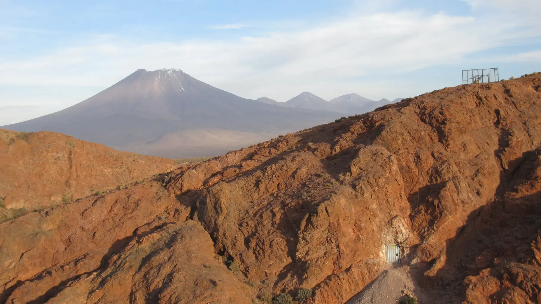
IPOC - Integrated Plate Boundary Observatory Chile
IPOC is an international network of institutions and scientists organising and operating a distributed system of instruments and projects dedicated to the study of the subduction system, its role in landscape evolution, and associated geohazards at …
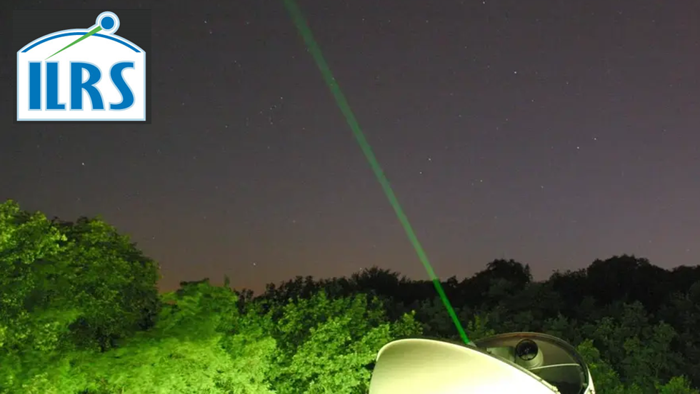
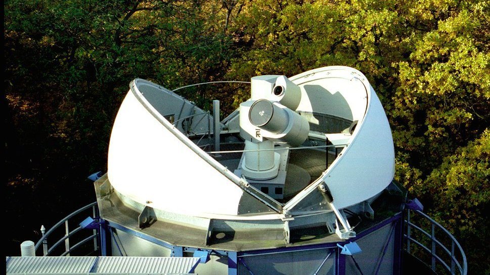
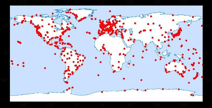
IVS - International VLBI Service for Geodesy and Astronomy
Very Long Baseline Interferometry (VLBI) is a highly accurate technique, used since the 1970s in geodesy that has delivered groundbreaking scientific discoveries. This technique allows scientists to measure global distances with millimeter accuracy;…
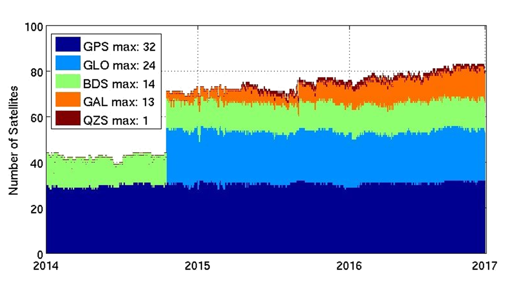
MGEX - Analysis Center of the Multi-GNSS Experiment
The Multi GNSS Experiment (MGEX) was initiated by the IGS in 2012. In MGEX all available signals of the new GNSS satellites are analysed. Currently, seven IGS analysis centers generate consistent and precise orbits and clock corrections of the new s…
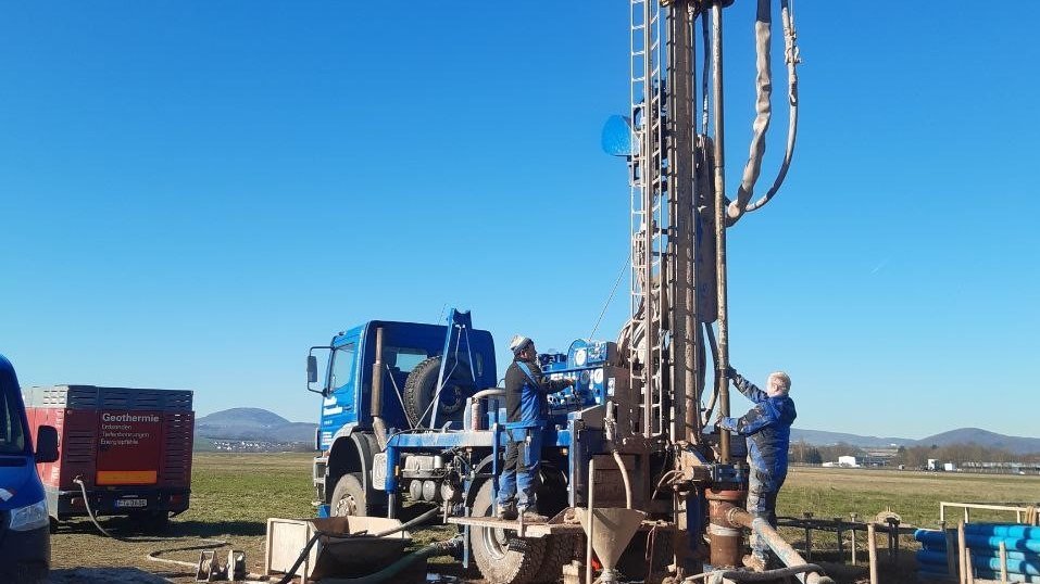
SMARTIES - Supercritical fluids and MAgma Reconnaissance for Transformative Iceland Energy Solutions
Recognizing that the exploration and harnessing of magmatic and geothermal reservoirs involves many disciplines, the mission of “SMARTIES” is to implement a long-term observatory facility together with episodic field experiments for defining, testin…
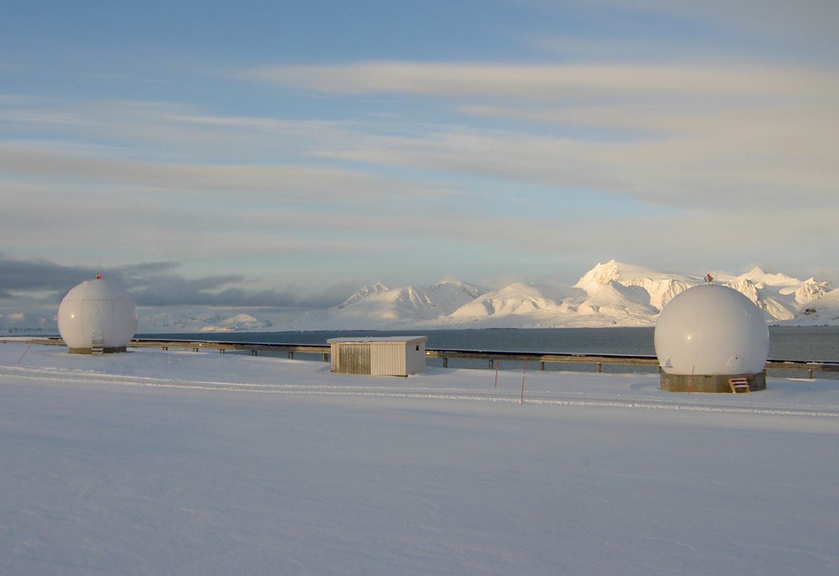
Satellite Receiving Station Ny-Ålesund (Spitsbergen)
The GFZ Helmholtz Centre for Geosciences operates a satellite receiving station at Ny-Ålesund, Spitsbergen (78° 55´ North, 11° 56´ East) to receive data from research satellites in polar orbits. The station is located about 1 km outside the village,…

TIGA - Processing Center of the Tide Gauge Benchmark Monitoring Working Group
Being a modern geodetic measuring method, GNSS (Global Navigation Satellite Systems) has reached an important role in geosciences. Within the scope of the Tide Gauge Benchmark Monitoring Working Group (TIGA-WG) of the IGS, GFZ analyses and reprocess…
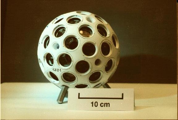
CHAMP - CHAllenging Minisatellite Payload inactive
CHAMP (CHAllenging Minisatellite Payload) was a German small satellite mission for geoscientific and atmospheric research and applications, managed by GFZ. With its highly precise, multifunctional and complementary payload elements (magnetometer, ac…

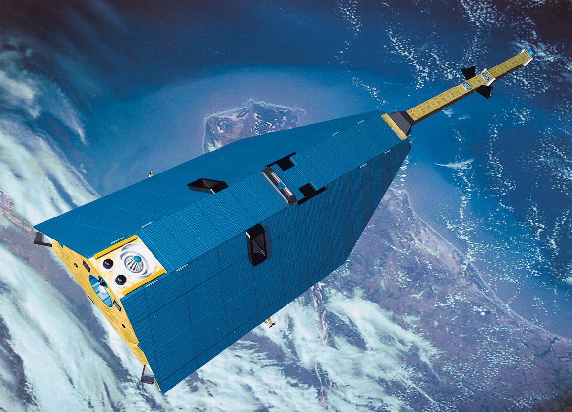
GOCE - Gravity Field and Steady-State Ocean Circulation Explorer inactive
The Earth explorer satellite GOCE (Gravity Field and Steady-State Ocean Circulation Explorer) was the first satellite mission within the framework of the Living Planet Program of ESA. This satellite mission was mapping the Earth's gravity field on g…
GRACE - Gravity Recovery and Climate Experiment inactive
GRACE was a joint project between the National Aeronautics and Space Administration (NASA) and the Deutsches Zentrum für Luft- und Raumfahrt (DLR). The mission has been proposed in 1996 jointly by the University of Texas at Austin, Center for Space …