
Search filter
Clear filters
-
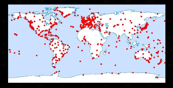
- Continuous GNSS Data
- Continuous GNSS Derived Products
- Controlled Source Seismological Data
- Earth Orientation Parameters
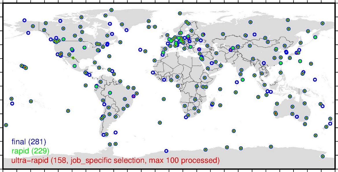
- Final Products
- GNSS Data
- GNSS Station and Satellite Metadata
- Model
- Observation Data and Derived Products for the Global Navigation Satellite Systems (GNSS)
- Precise Station Coordinates
- Processed GPS Products
- Rapid Products
- Satellite Clock Corrections
- Satellite Data
- Satellite Orbits
- Ultra-rapid Products
GNSS
Got 7 results.

GFZRNX - RINEX GNSS Data Conversion and Manipulation Toolbox
GFZRNX is a toolbox designed and created for the needs of the GNSS community. It supports RINEX observation, navigation and meteorological data. The major tasks include checking, repairing and manipulating (sampling, selection of satellite systems a…


TIGA - Processing Center of the Tide Gauge Benchmark Monitoring Working Group
Being a modern geodetic measuring method, GNSS (Global Navigation Satellite Systems) has reached an important role in geosciences. Within the scope of the Tide Gauge Benchmark Monitoring Working Group (TIGA-WG) of the IGS, GFZ analyses and reprocess…