
Search filter
Clear filters
-
- GFZ
- Department 1 Geodesy
- Section 1.1 Space Geodetic Techniques
- Section 1.2 Global Geomonitoring and Gravity Field
- Section 1.3 Earth System Modelling
- Section 1.5 Space Physics and Space Weather
- Department 2 Geophysics
- Section 2.1 Physics of Earthquakes and Volcanoes
- Section 2.2 Geophysical Imaging
- Section 2.3 Geomagnetism
- Section 2.4 Seismology
- Section 2.6 Seismic Hazard and Risk Dynamics
- Department 5 Geoinformation
- Section 5.1 Data and Information Management
- Section 5.2 eScience Centre
-
- Archaeomagnetism
- Controlled Source Seismology
- Earth System Modelling
- Electromagnetics
- Geochemistry
- Geodesy and Gravity
- Geology
- Tectonics
- Geomagnetism
- Geomagnetism and Paleomagnetism
- Geophysics
- Geodynamics
- GNSS
- Gravimetry
- Laboratory Keywords
- Analytical Methods
- Computational Methods
- Visualization Methods
- Visualization
- In Situ/Laboratory Instruments
- Material Properties
- Coercivity
- Curie Temperature Analysis
- Demagnetization
- Magnetic Hysteresis Analysis
- Magnetic Susceptibility
- Magnetization
- Mass-Specific Magnetic Susceptibility
- Remanent Magnetization
- Sample Preparation
- Magnetic Extraction
- Digital Image Correlation Techniques
- Particle Image Velocimetry
- Magnetotellurics
- Natural Hazards
- Palaeomagnetism
- Paleogeosciences
- Paleogeoscience
- Seismic Hazard
- Seismology
- Space Weather
- Tectonophysics
- Volcanology
-
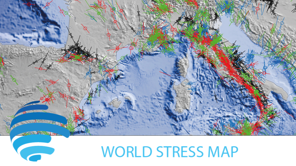
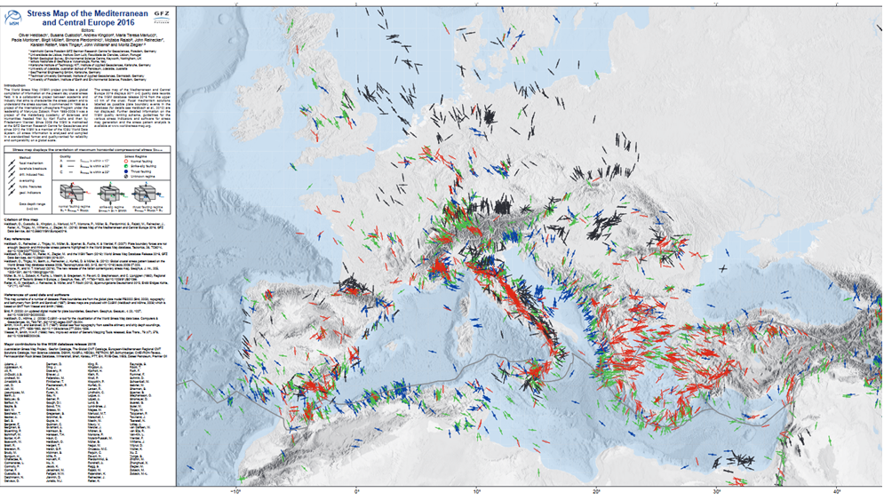
- Contemporary Crustal Stress
- Continuous GNSS Data
- Continuous GNSS Derived Products
- Controlled Source Seismological Data
- Earth Magnetic Field Data
- Earth Orientation Parameters
- Electric Data
- Electromagnetic Data
- Final Products
- Geomagnetic Field Models
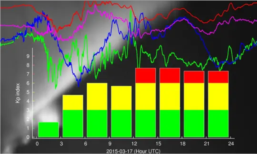
- Geomagnetic index
- GNSS Data
- Historical Earthquakes
- Magnetic Data
- Magnetotelluric Data
- Model
- Observation Data and Derived Products for the Global Navigation Satellite Systems (GNSS)
- Passive Seismological Data
- Rapid Products
- Satellite Data
- Satellite Orbits
- Seismic Events
- Ultra-rapid Products
Department 2 Geophysics
ArchKalmag14k - Correlation based model of the holocene core field, based on archeomagnetic and volcanic data
ArchKalmag14k is constructed using methods from Bayesian statistics, in particular Gaussian processes and the Kalman filter, to reflect uncertainties in data and modeling. Additionally to the field coefficients, covarianz matrices and a model ensemb…

CALSxk (10.000 - 3.000 years BP) - Geomagnetic field model for the period 10.000 - 3.000 years BP
Geomagnetic field models of the last 3 to 10 kyrs based on archeo- and paleomagnetic data. This updated version of geomagnetic field description for the past 10 000 years is mainly based on the same data as CALS10k.1b. However, the model offers high…
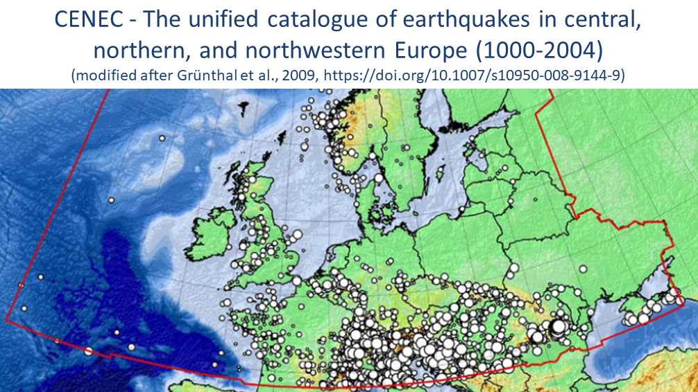
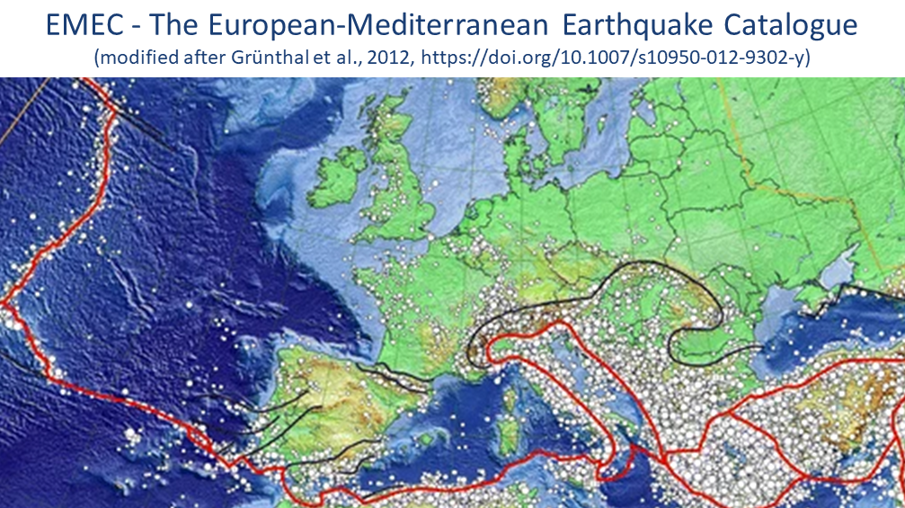
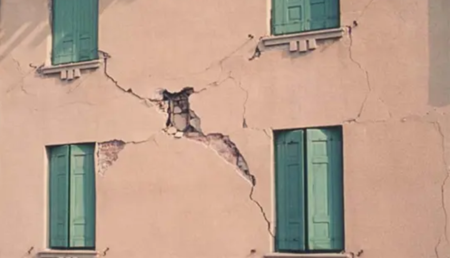
CENEC 2008 - Mw based Earthquake Catalogue for Central, Northern and Northwestern Europe
The unified catalogue of earthquakes in central, northern, and northwestern Europe: Grünthal et al. (2009) published a catalogue for central, northern, and northwestern Europe with unified Mw for events with Mw ≥ 3.5 in the time frame 1000-2004. Thi…
CVO - Central European Volcanic Province Observatory
The primary scientific goal of the Central European Volcanic Province Observatory is to better understand and map the processes in transcrustal magma systems beneath distributed intraplate volcanic fields, and to assess their volcanic hazard and the…
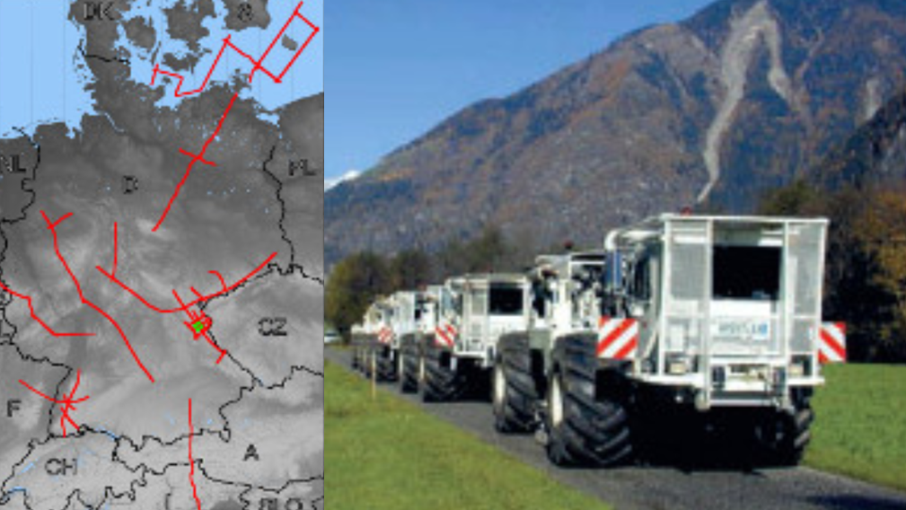
DEKORP - German Continental Seismic Reflection Program
DEKORP (Deutsches Kontinentales Reflexionsseismisches Programm) was carried out between 1984 - 1997 as the German national reflection seismic program funded by the Federal Ministry of Education, Science and Technology (BMFT), now Federal Ministry of…
DEPAS | German Instrument Pool for Amphibian Seismology
The "German instrument pool for amphibian seismology" (Deutscher Geräte-Pool für amphibische Seismologie | DEPAS) provides broadband-onshore stations and ocean bottom seimometers for the preferred use within amphibious projects. The onshore componen…

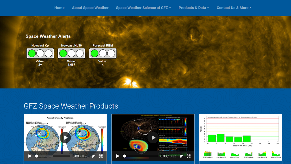
Declination Calculator for the International Geomagnetic Reference Field IGRF
The declination calculator provides declination values for any location on Earth and any time between 1900 and 2025. The calculation is based on the International Geomagentic Reference Field (IGRF) which describes the geomagnetic core field. The cal…
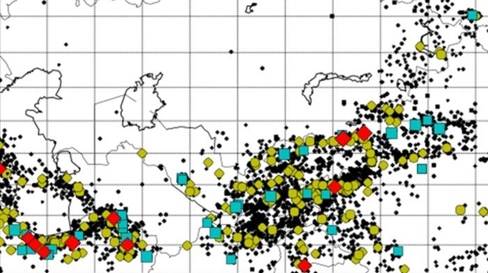
EMEC - The European-Mediterranean Earthquake Catalogue (Version 2021 and earlier versions)
EMEC-2021 is a catalogue of tectonic earthquakes for the broader Mediterranean area, harmonised into a single magnitude scale, Mw (Lammers, Steffi et al., 2023). It is an extended version of “The European-Mediterranean Earthquake Catalogue (EMEC) fo…


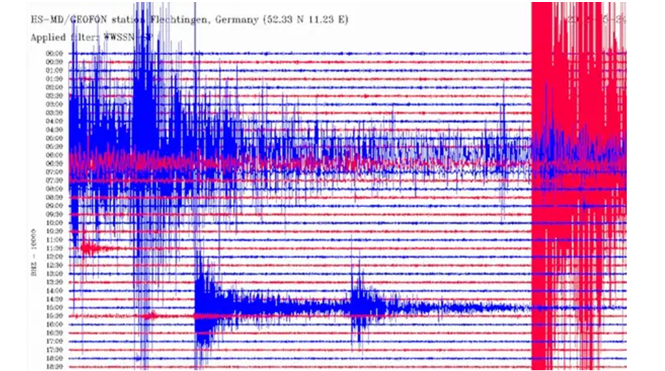
GE Seismic Network - GEOFON Global Seismic Network
In 2018 the GEOFON global seismic network consists of more than 80 active high quality stations with real-time acquisition. The network plays a leading role in global real-time seismology providing valuable data for almost all fundamental and applie…
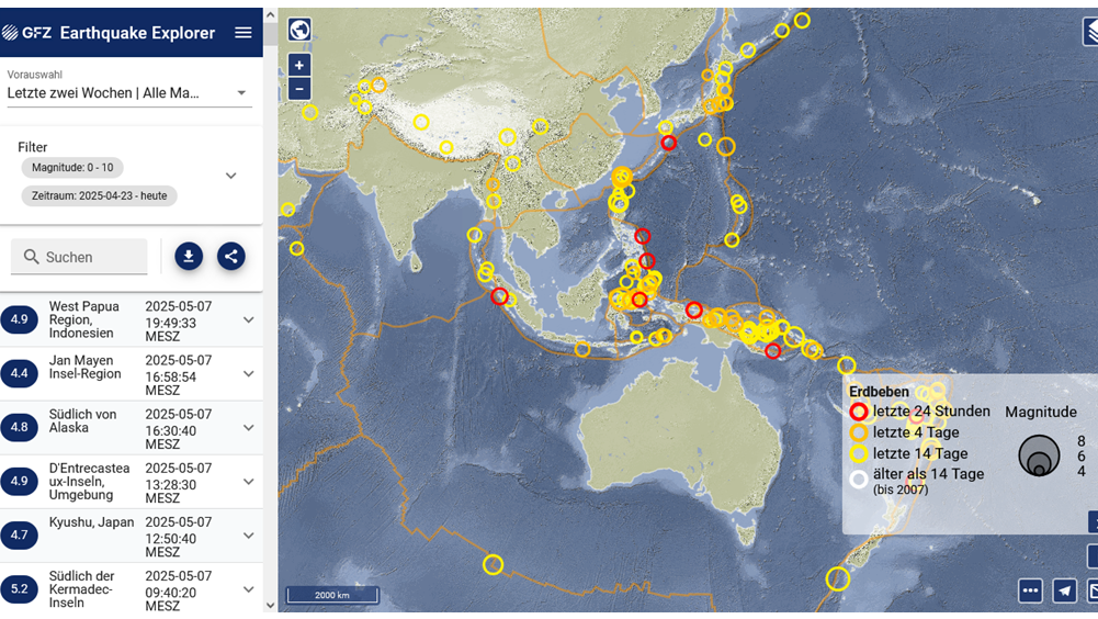

GEOFON Eqinfo - GEOFON Global Earthquake Monitoring System
All real time data streams from GEOFON stations as well as around 900 additional real-time stations from international partners are used to determine rapid automatic location estimates for all globally recorded earthquakes and most regional ones. Th…

GEOFON Seismological Software
GEOFON has a long tradition of developing high-quality open software products for the seismological reasearch community. The best example is probably the SeisComP3 package (http://www.seiscomp3.org), which became one of the most widely used in the c…
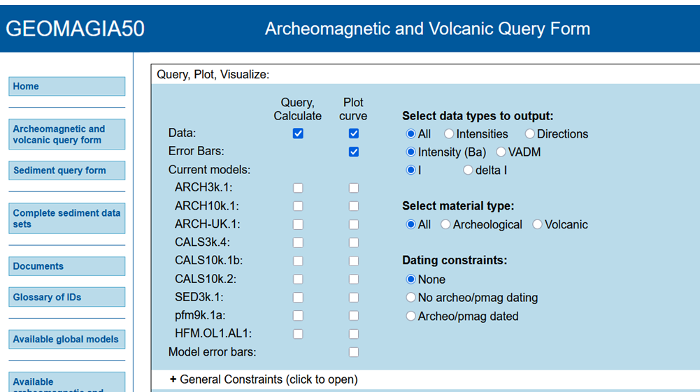
GEOMAGIA50 – Paleomagnetic and Chronological Data for the Past 50 Ka
The GEOMAGIA50 database is an international collaboration to provide easy access to published archeomagnetic/volcanic and sediment paleomagnetic and chronological data for the past 50,000 years. GEOMAGIA50 has been funded by the US National Science …
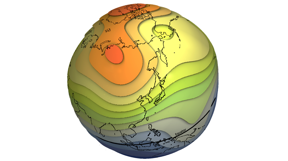
GGF100k - Model that covers the past 100.000 years and it is the longest global reconstruction of the geomagnetic field
GGF100k is a global geomagnetic field model covering the past 100,000 years. It is the first model that provides a global view of the geomagnetic field evolution over an extended period. The model is based on an extensive global dataset of over 100 …
GGFMB - global geomagnetic field reconstruction for the period between 900,000 and 700,000 years
GGFMB is a global geomagnetic field reconstruction for the period between 900,000 and 700,000 years ago. It includes, in particular, the last complete field reversal approximately 780,000 years ago, the transition from the Matuyama chron with revers…
GGFSS70 - Geomagnetic model that covers the period of 70 - 15 kyrs, that includes 3 geomagnetic excursions
The GGFSS70 is a global geomagnetic field model covering the period 70,000 to 15,000 years ago. The model is based on nine selected sediment records from globally distributed sites. The dataset contains only high-quality paleomagnetic records, with …

GIPP | Geophysical Instrument Pool Potsdam
The "Geophysical Instrument Pool Potsdam (GIPP)" by GFZ provides seismic, magnetotelluric and geodetic instruments and sensors for projects of GFZ groups, universities and other research facilities. It is hosted by Section 2.2 | Geophysical Imaging …
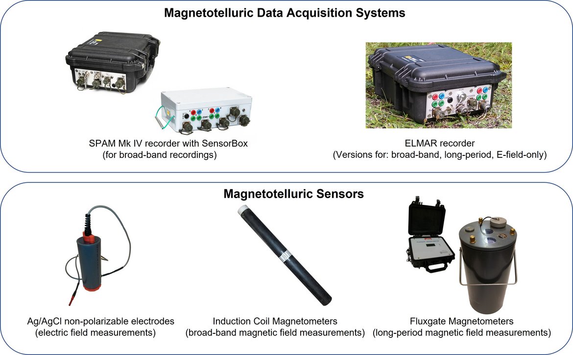
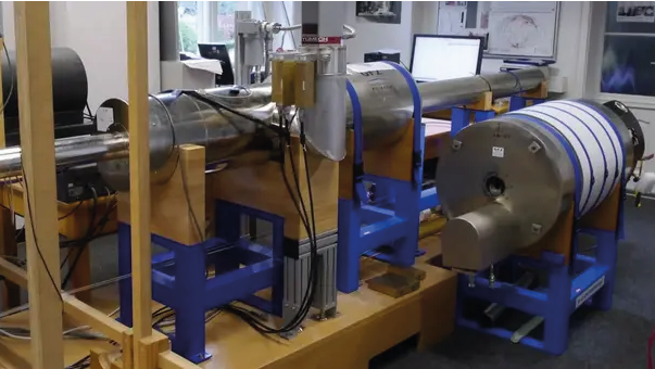
GIPP-MT - Magnetotelluric component of the "Geophysical Instrument Pool Potsdam"
The magnetotelluric instruments are part of the "Geophysical Instrument Pool Potsdam (GIPP)" which means that the instruments are generally available for academic use to all German Universities. The allocation of the instruments is decided by the GF…
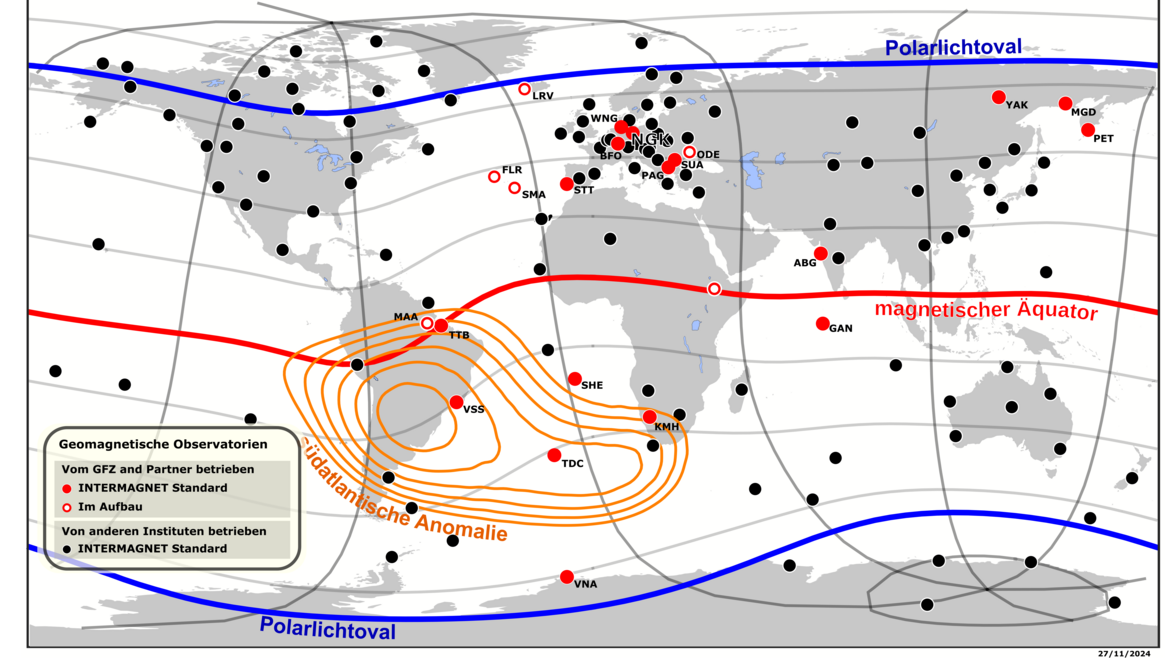

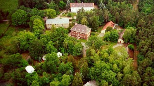
Geomagnetic Observatory Niemegk (NGK)
The Adolf-Schmidt-Observatory for Geomagnetism in Niemegk is operated by GFZ since 1992. It belongs to Section 2.3, Geomagnetism. The observatory is located 50km SW of Potsdam. Since 1930 it continues the measurements, that started in Potsdam in 189…


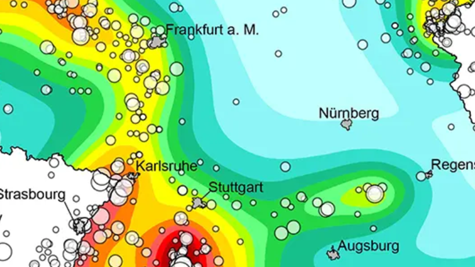
German Earthquake Zonation Map (German Building Code DIN EN 1998-1/NA-2011-01)
Service for assigning of localities in Germany (based on names or zip code) to seismic zones according to the earthquake resistant German Building Code DIN EN 1998-1/NA:2011-01, zonation map (former DIN 4149:2005-04) (only available in German and fo…
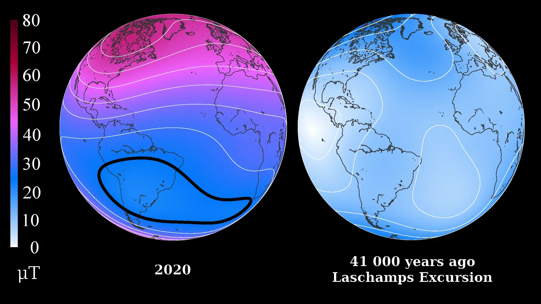
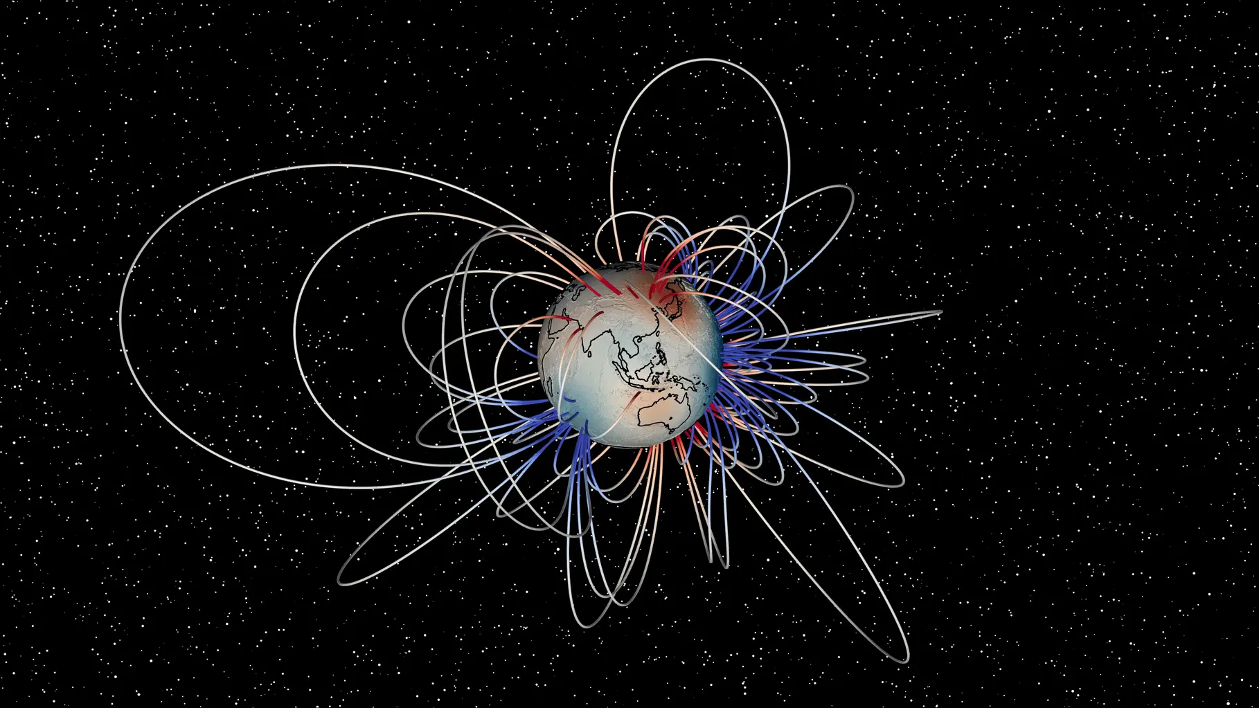
LSMOD Models - Models for the periode of 30 to 50 kyrs that contain the Laschamp and Mono Lake field excursions
Geomagnetic field models for the periode of 30 to 50 kyrs that contain the Laschamp and Mono Lake field excursions. The LSMOD models (current version LSMOD.2) represent the global evolution of the geomagnetic field for the time interval 50 to 30 ka.…
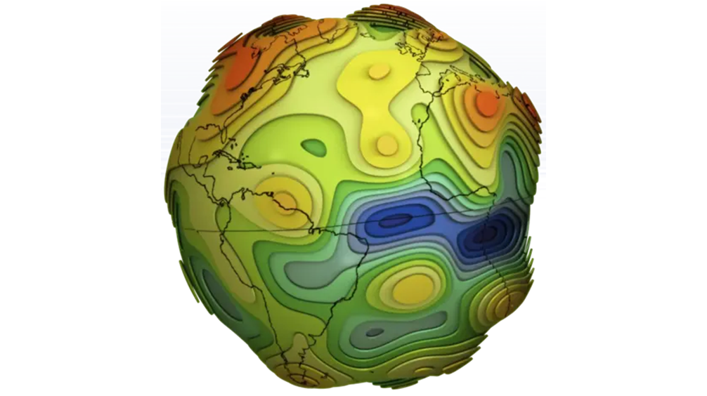
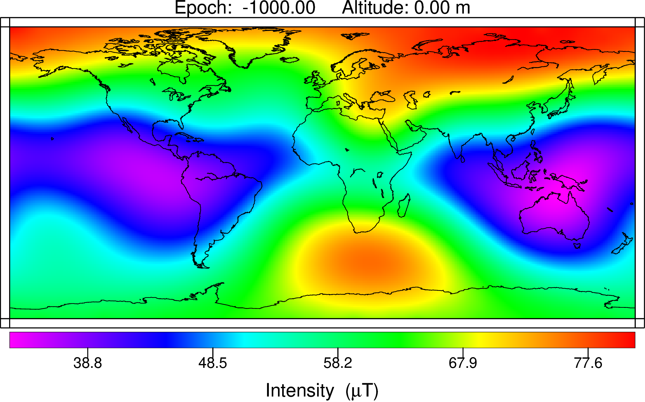
Mag.num - Model of the geomagnetic core field, based on satellite and observatory data
Mag.num models are the series of recent GFZ high-precision geomagnetic core field models that rely on satellite magnetic field measurements, in particular on calibrated Swarm and CHAMP vector field and ground observatory data. The coefficients of th…

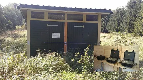
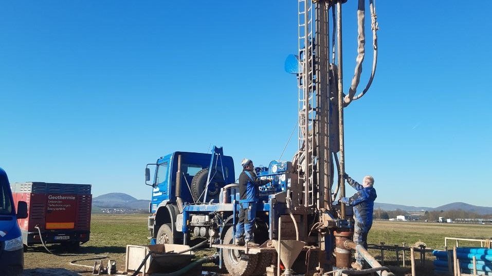
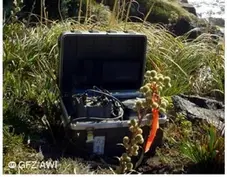
Permanent Magnetotelluric Reference Station in Wittstock, Germany
The sources for the magnetotelluric (MT) method are naturally occurring electromagnetic field variations. Electromagnetic currents are excited over a wide frequency range in the earth’s ionosphere by solar activity and global lighting discharges. Wh…

SHEEC - the SHARE European Earthquake Catalogue 1900-2006
The SHARE European Earthquake Catalogue (SHEEC) 1900-2006 has been compiled by GFZ Potsdam in the frame of an independant project and represents a temporal and spatial excerpt of "The European-Mediterranean Earthquake Catalogue" (EMEC) for the last …
SMARTIES - Supercritical fluids and MAgma Reconnaissance for Transformative Iceland Energy Solutions
Recognizing that the exploration and harnessing of magmatic and geothermal reservoirs involves many disciplines, the mission of “SMARTIES” is to implement a long-term observatory facility together with episodic field experiments for defining, testin…
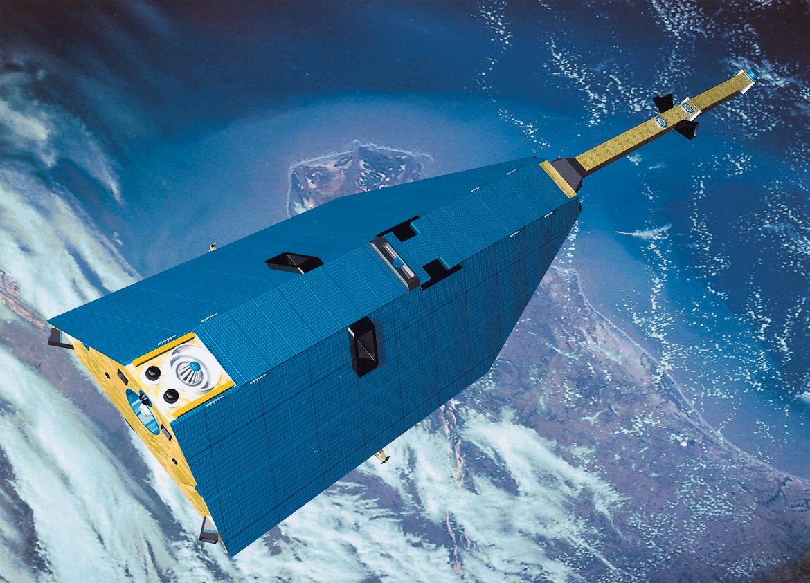
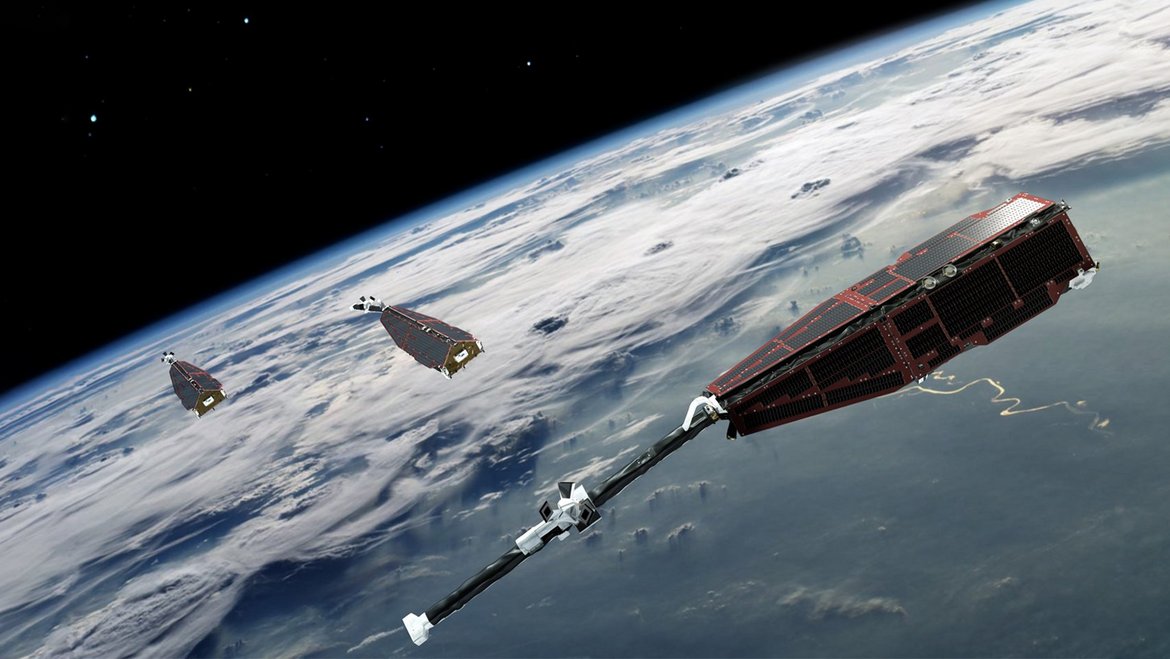
CHAMP - CHAllenging Minisatellite Payload inactive
CHAMP (CHAllenging Minisatellite Payload) was a German small satellite mission for geoscientific and atmospheric research and applications, managed by GFZ. With its highly precise, multifunctional and complementary payload elements (magnetometer, ac…